6 Spectacular National Park Sites in Minnesota
6 Spectacular National Park Sites in Minnesota
By James Riemermann
Aside from its peerless national park (Voyageurs, a world-renowned Dark Sky destination), Minnesota boasts five striking national park sites that fully reflect our natural, historical and cultural resources. Here is what you can expect from each one of them.

Voyageurs National Park in northeast Minnesota offers a uniquely water-based experience among national parks
VOYAGEURS NATIONAL PARK
Voyageurs National Park is uniquely water-based among national parks, with its interior accessible only by water. Over 200 sites designated for houseboats, tent camping or day use dot the shores of four large, island-studded lakes and dozens of smaller lakes along the Canadian border. Within the park's more than 200,000 acres, there are roughly 500 islands and 655 miles of shoreline to explore.
The park is named after the French Canadian voyageurs — French for “travelers” — who paddled these waterways in large birch bark and cedar canoes in the 17th and early 18th centuries, trapping and transporting pelts of beaver, otter and mink.
Today, visitors enter by motorboat, canoe, kayak and sailboat for day trips or camping within the park. But Voyageurs is perhaps best known as Minnesota’s premier destination for houseboat vacations. Imagine a luxurious floating vacation home moored on your own private bay or island, with a hot tub and a waterslide for the kids, and a motorboat attached for fishing or exploring the park’s extraordinary sights. Houseboats can be rented from businesses just outside the park.

Credit: Kettle Falls Hotel
Tent camping sites are accessible right on the shores of the larger lakes, but there are also hike-in sites on smaller lakes within the vast interior of the Kabetogama Peninsula. The hike-in sites are accessible by way of the park’s trails, the trailheads of which can be reached by boat. Some of the 15 hiking trails are accessible by car on the southern border of the park, but no campsites can be reached without a boat.
For shorter trips, the Kabetogama, Ash River and Rainy Lake visitor centers provide guided boat tours, hikes and canoe excursions into the park. Some boat tours take visitors to the historic Kettle Falls Hotel, which was built in 1913 near a dam between Namakan and Rainy lakes and offers lodging and dining.
Recent projects at Voyageurs include improvements to the Cruiser Lake Trail, which spans the Kabetogama Peninsula, and a new recreational trail by the Rainy Lake Visitor Center.

Canoeing on the Mississippi River takes you directly beneath the Stone Arch Bridge
MISSISSIPPI NATIONAL RIVER & RECREATION AREA
A 72-mile-long river park covers 54,000 acres from Dayton to Hastings, passing right through the heart of Minneapolis and St. Paul. The Mississippi National River & Recreation Area is considered a “partnership park." This means it works alongside local, regional and state partners who own and manage land along the river to protect and preserve its wealth of natural, recreational, historic and cultural resources.
The recreation area offers a variety of park ranger-led activities, such as talks, demonstrations, hikes, and occasional opportunities to get out on the water. Most activities are coordinated out of the Mississippi River Visitor Center, which features new exhibits, in the lobby of the Science Museum of Minnesota in downtown St. Paul.
A few of the many worthwhile stops along the route including hiking, biking and fishing at Coon Rapids Regional Park and Hidden Falls-Crosby Farm Regional Park in St. Paul; a two-mile self-guided Heritage Trail at the powerful St. Anthony Falls in Minneapolis; living history demonstrations at Historic Fort Snelling; and fishing, walking, biking and taking in the view at Hastings River Flats Park.

The St. Croix National Scenic Riverway encompasses some of the most scenic and least developed country in the Upper Midwest
ST. CROIX NATIONAL SCENIC RIVERWAY
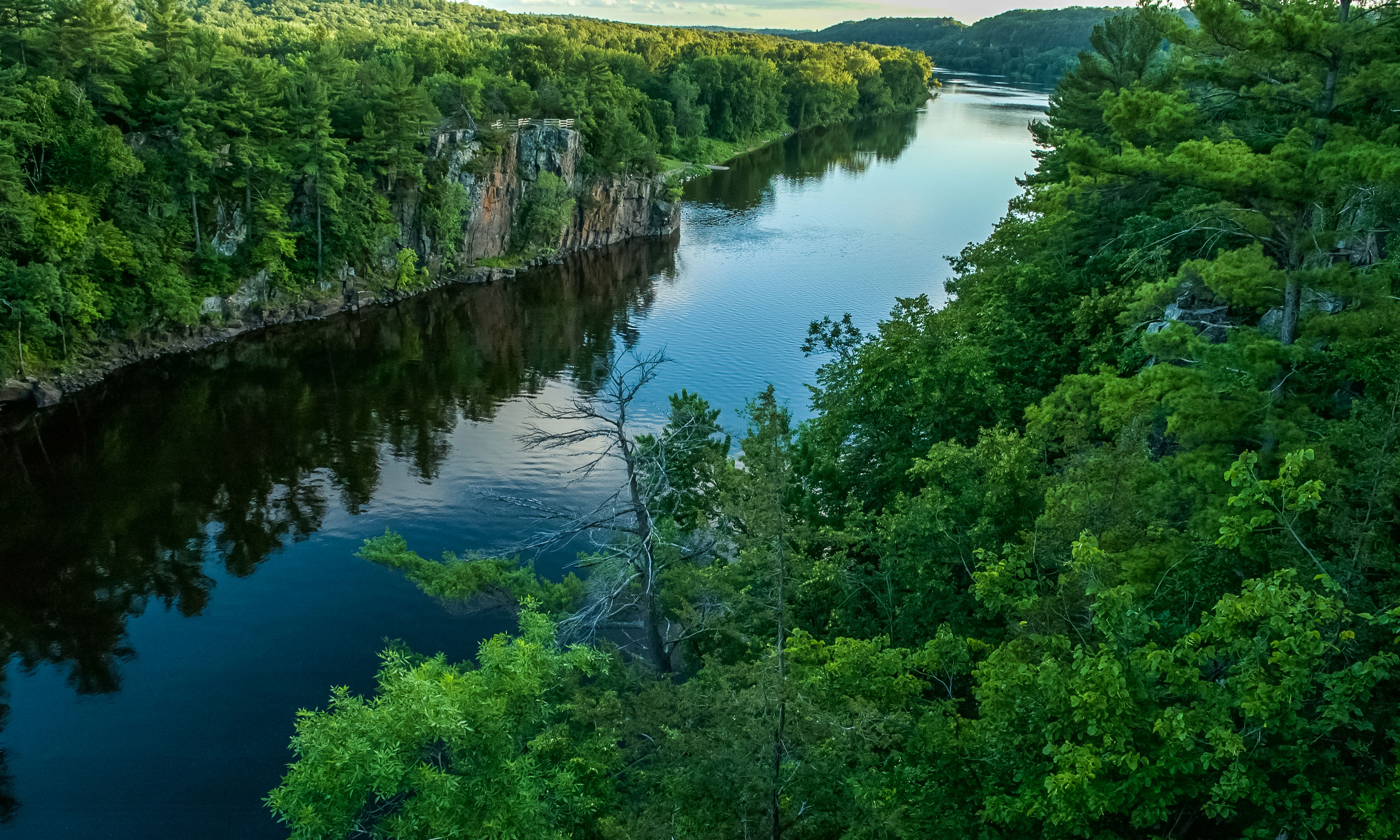
Much of the 164-mile St. Croix River forms the border between Minnesota and Wisconsin, and it was one of only eight waterways originally designated as a “National Wild and Scenic River” by the federal government in 1968. It’s widely considered one of the best canoeing rivers in the nation, and also offers some of the best smallmouth bass fishing to be found, as well as great fishing for many other species.
The Minnesota portion of the scenic river runs from St. Croix State Park, north of Pine City, to where the St. Croix meets the Mississippi River at Hastings. In addition to five particularly gorgeous state parks, there are numerous regional and city parks as well as primitive National Park Service campsites along the shore.

Kayaking with Taylors Falls Scenic Boat Tours / Credit: Jordana Torgeson
The portion of the river north of Taylors Falls is particularly quiet and remote from signs of civilization, with motorboats less common than canoes. Motorboats are more common below Taylors Falls, though canoeing and kayaking are quite popular along the entire river.
Just below the dam, Interstate State Park has self-guided trails along distinctive glacial potholes and dramatic cliffs overlooking the river, where rock climbing is popular as well. Adjacent to the park, Wild Mountain runs guided paddleboat excursions, some with meals, from May through the fall color season in mid-October.

Pipestone National Monument / Paul Vincent
PIPESTONE NATIONAL MONUMENT
The American Indian tradition of quarrying pipestone to make into sacred pipes and other items is still practiced today at Pipestone National Monument. This makes it the only site in the National Park System where resources can be removed from the grounds. Tribes from the area and beyond come here to quarry the stone using sledgehammers, chisels and other handheld tools; the waiting list for the required permit is as much as 10 years out.
Visitors can tour the grounds to see the 56 active quarry pits, the native tallgrass prairie, quartzite rock formations and Winnewissa Falls. Inside the visitor center, a museum tells the story of the site’s history and culture, and craft workers demonstrate the art of creating pipestone goods.
The site is open daily year-round for hiking and touring the visitor center. Organized interpretive programs, including talks and guided walks, are available in the summer. If you’re traveling with kids, ask about the junior ranger and birder programs.

Hikers on elevated trail on North Country National Scenic Trail / Marcus Schaffer
NORTH COUNTRY NATIONAL SCENIC TRAIL
Once complete, the North Country National Scenic Trail will be the longest continuous hiking trail in the United States. Currently, Minnesota’s portion includes the Superior Hiking Trail along the North Shore of Lake Superior, which is open for backcountry camping and day hikes between access points with parking.
The Border Route and Kekekabic are wilderness trails appropriate for experienced backcountry hikers, passing through the heart of the Boundary Waters Canoe Area Wilderness. Don’t miss the 270-degree overlook where the Border Route and Superior Hiking trails meet.
A 70-mile section through Chippewa National Forest, and sections passing near the Mississippi headwaters in Itasca State Park, are open for both camping and day hikes, accessible via several towns along the route.

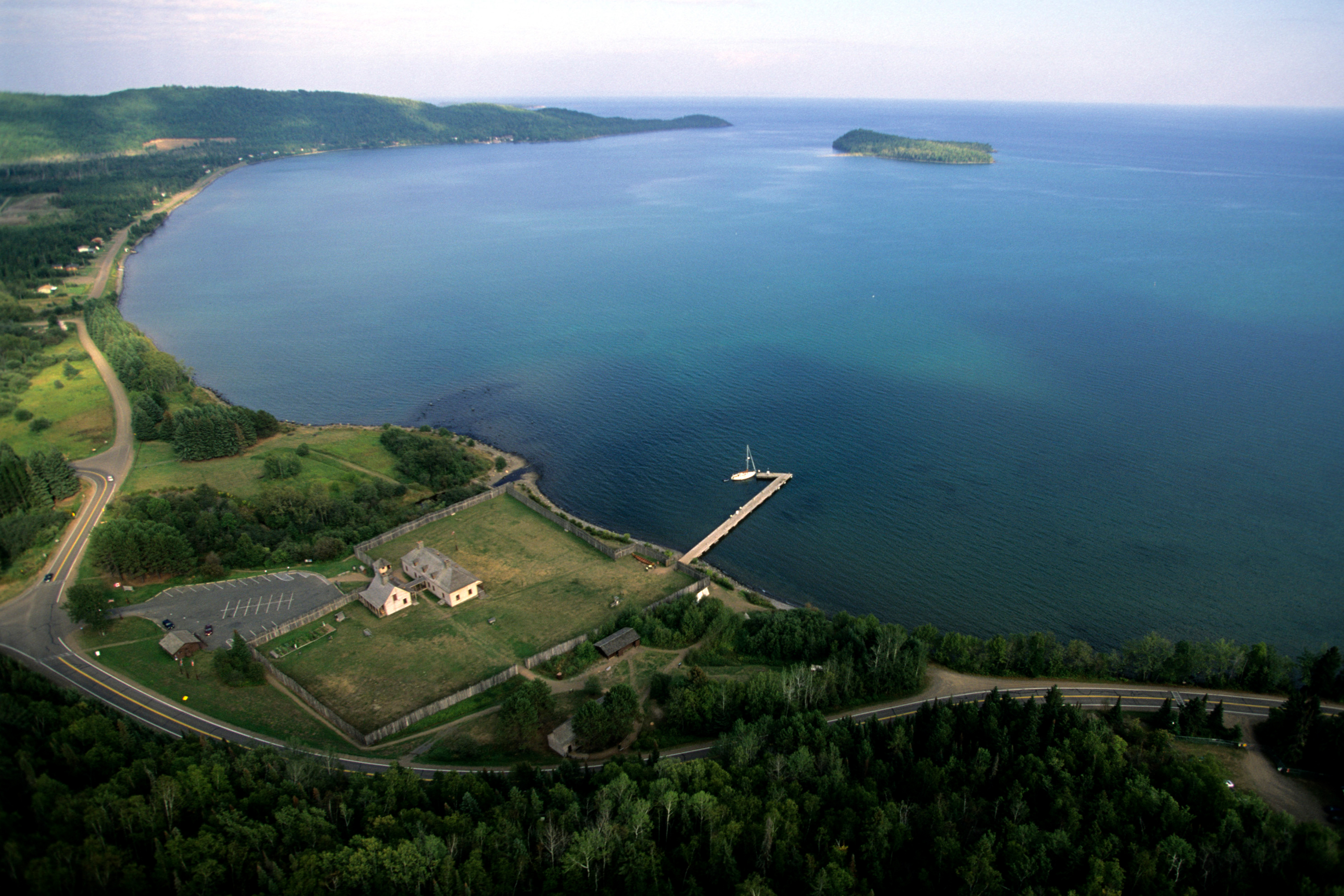
An aerial view of Grand Portage National Monument
GRAND PORTAGE NATIONAL MONUMENT
Grand Portage National Monument is a living history site on the northeast tip of Minnesota overlooking Lake Superior. Volunteers and park staff in period attire reenact and describe the site’s importance to the French-Canadian fur trade of the early 1800s, and to the Indians who initially guided those voyageurs based on their centuries of experience.
Living history activities occur in and around the Historic Depot, which has a log-built great hall, kitchen and canoe warehouse, as well as an adjacent Ojibwe village and voyageurs’ encampment. The Heritage Center offers museum exhibits, films and books that shed light on the site’s significance.
On the second weekend in August, the highlight of the year is Grand Rendezvous Days and the Rendezvous Days Powwow, the latter sponsored by the Grand Portage Band of Lake Superior Chippewa (Ojibwe).

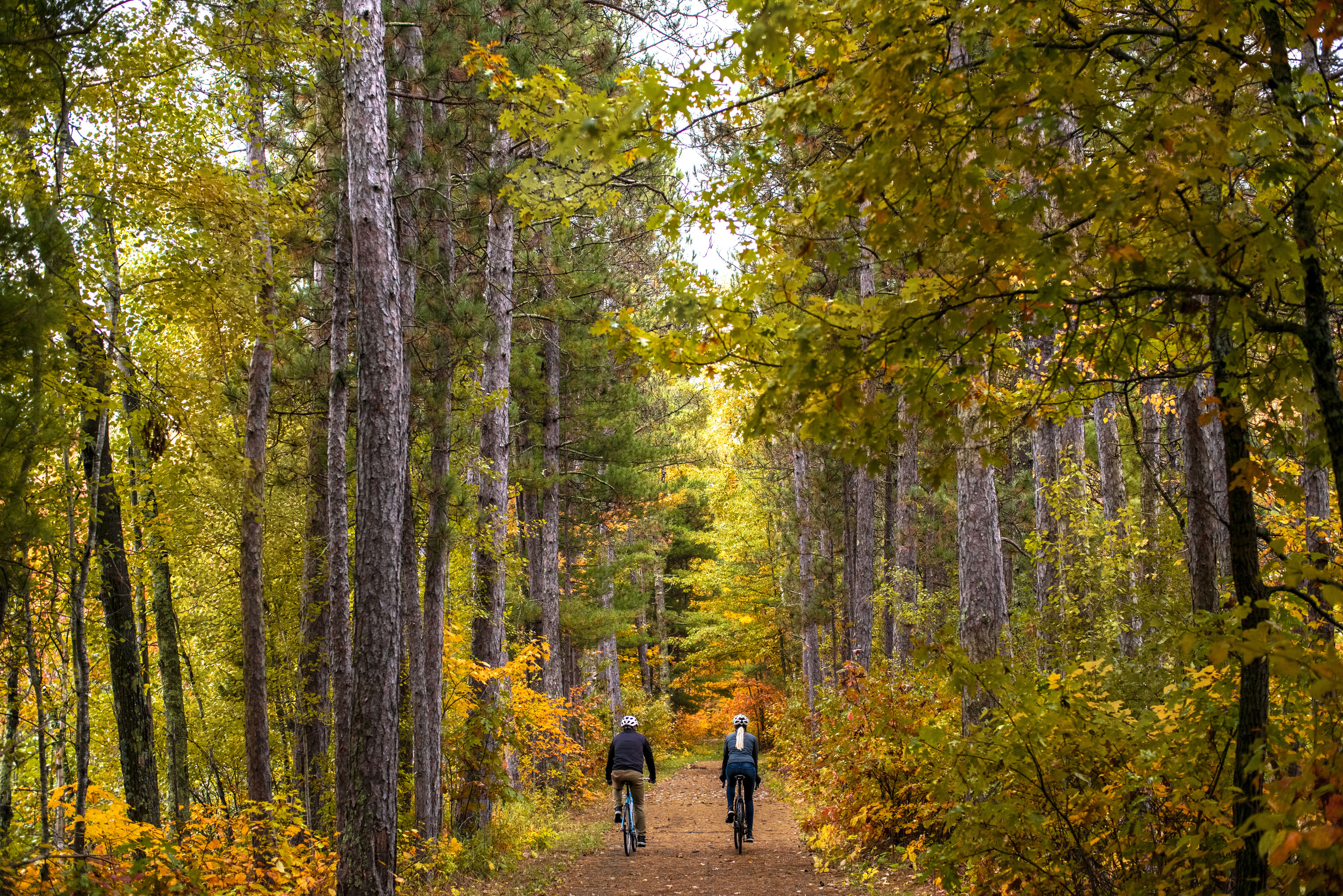
Pedal on remote dirt roads and trails in the Chippewa National Forest / Micah Kvidt
NATIONAL FORESTS
Superior National Forest covers just under 4 million acres in the northeast corner of the state. More than a quarter of the forest is the Boundary Waters Canoe Area Wilderness, a world-renowned destination for wilderness canoeing, almost all of which is paddle only with no motors allowed. The Boundary Waters has more than 2,000 remote campsites accessible via 1,500 miles of canoe routes, with overland portages between lakes along the Minnesota-Canada border.
Outside of the Boundary Waters, the forest has more than 1,000 car-accessible campsites within developed campgrounds, as well as rustic and dispersed camping with minimal or no facilities.
Chippewa National Forest covers over 666,000 acres east of Bemidji, with more than 1,300 lakes and 923 miles of rivers and streams. There are 21 developed campgrounds, some rustic and others with running water and other modern amenities. Additionally, there are several hundred simply maintained backcountry sites as well as dispersed camping outside of established campsites.
Find out more about Minnesota's stellar park system.


